Direct answer
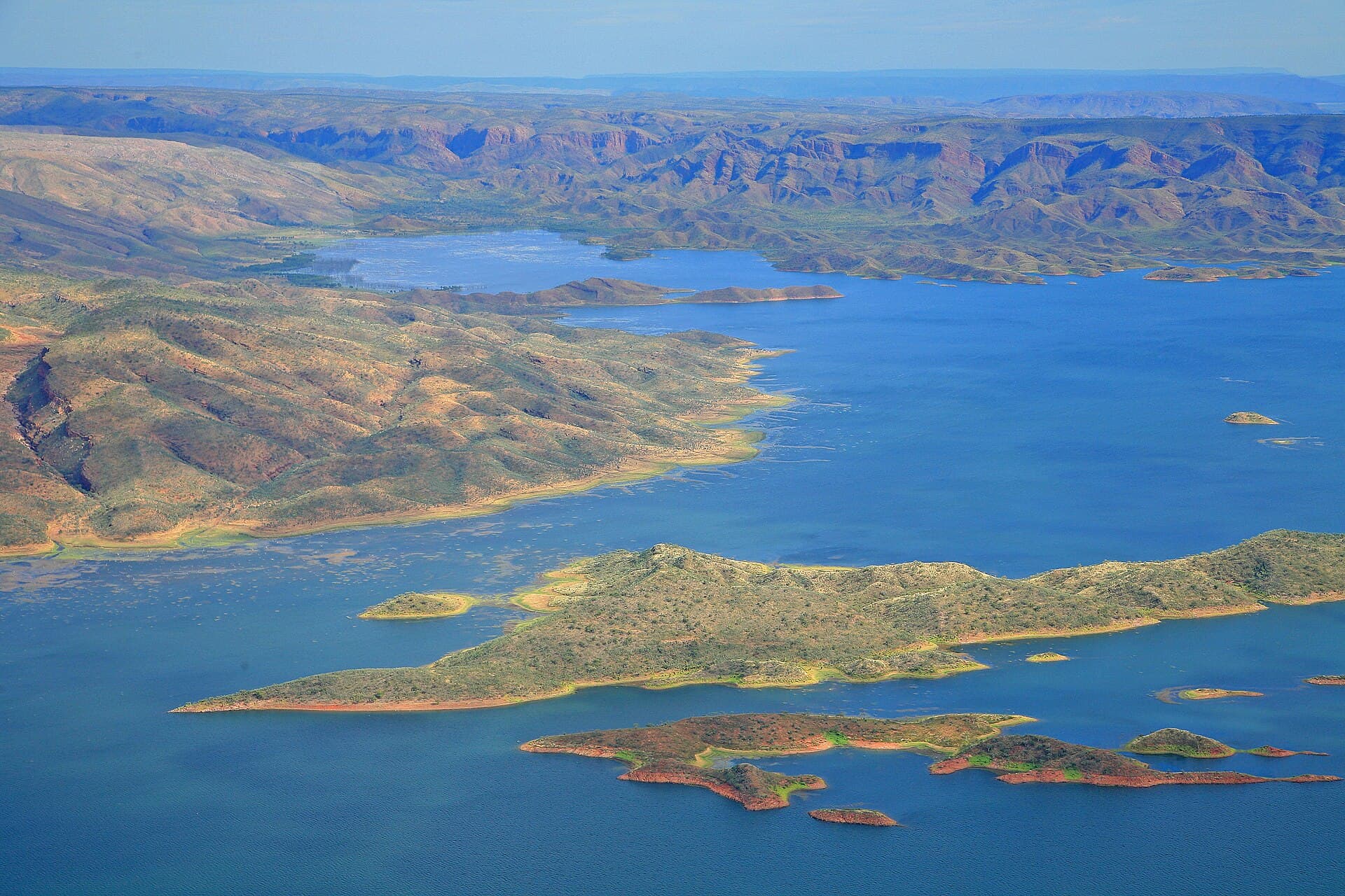
The Ord River is why Kununurra exists: a dammed, diverted, irrigated north on Miriwoong country. Lake Argyle is the big reservoir behind the 1971 dam. A second structure at Kununurra manages water for the scheme. Cruises use river stretches or the lake; they are related water and different products. Swimming is a crocodile-and-current decision, not a vibe. Read the itinerary for which water you will sit on.
The scheme in plain language
Mid-century Australia decided this river could grow a district. The town followed the water. Bananas, sandalwood experiments, sandalwood arguments, and a grid of irrigation channels are the visible modern layer. Under that layer is Country that did not ask for a dam. A decent visit holds both facts. A poor one only photographs a pump.
Tourism WA will show you produce and sunsets. Local interpretation, when you find it, will show you more. We are a planner, not the native title record.
Lake, river, diversion
Lake Argyle is the inland sea people book boats for. The river below the dams is a different cruise if an operator offers it — narrower, more “river,” sometimes wildlife-heavy in a quieter way. Diversion channels are working water. Do not treat them as swimming lanes.
Ivanhoe Crossing sits on this story: a causeway that is a photo in the dry and a serious or closed crossing when the river says so. Do not play hero.
Crocodiles
Freshwater crocodiles are at home here. Estuarine crocodiles use some tidal systems toward the gulf. Signs are not decorations. The wildlife page is the field note. This page will not give you a safe-swim map.
How to visit the idea, not only the lake
Drive the dam wall (heat). Take a lake boat (light). Walk Mirima and look back at irrigation flats (context). Read a visitor-centre board if one is open. Talk less. The river does not need your take.
Parks Australia context matters if you compare this engineered water to a federal park river elsewhere. DBCA still owns the national parks on the same holiday. A water corporation landscape is not a park pass.
Planning table
| Interest | Do | Pair with |
|---|---|---|
| Engineering | Dam wall + a board | Town lookout |
| Scale | Lake cruise | Not a 4WD day |
| Country | Listen, read, don’t drone | Country note |
| Birds | Edges of day, irrigation | Wildlife essay |
Why this page exists on the URL map
The brief asked for /destinations/ord-river/ so the river is not only a caption on the lake page. The lake page is the product planner. This page is the why. Cross-link and move on. Kununurra is the town the scheme built. Getting there is how you arrived to look at it.
Historic operator copy sometimes sold “Ord River sunset” as a mood. We rewrote the mood as geography. No prices. No #1. If a cruise is cancelled, the river will still be here in the morning — unlike your prepaid 4WD day if you stacked them.
Standing at the wall without a speech
You can look at cubic metres and still know the river had a name and a people before the scheme. You do not need to perform a speech at the rail. You do need not to litter, not to drone a private grief, and not to treat a crocodile as a prop.
Irrigation as landscape
Channels, paddocks, and the grid of a town that followed water: this is East Kimberley as much as a dome. Drive it at a human speed. The produce story is real and so is the argument about who the water was for. Both can sit in the same afternoon.
River cruise versus lake cruise, again
If the itinerary says river, you may get narrower banks and a different wildlife rhythm. If it says lake, you get scale. If it says both, read twice. Operators are allowed to use words loosely; you are allowed to ask.
Ivanhoe Crossing as a sentence, not a playground
In the dry it can be a photograph. In the wet it can be a closed or serious crossing. Do not let children treat a causeway as a park. The river does not care that you wanted a story.
How to visit the scheme without a boat
Drive the dam wall with water in the bag. Stand at a town lookout and look at irrigation flats. Read a visitor-centre board if one is open. Walk Mirima and notice how the quartzite sits against a grid that only exists because someone dammed a river. That afternoon is an Ord visit. It costs no cruise fare and it still requires crocodile sense at any bank you do not know.
If you then book a boat, you will know which water you wanted. If you do not, you still understood why Kununurra is here. That was the job of this destination slug.
The scheme as the reason the town exists
The Ord River Irrigation Scheme is why Kununurra has a chemist at 5 p.m. and a lake industry at sunset. The 1971 dam created Lake Argyle and a working grid of channels and farms. Visiting the Ord is standing on the wall, reading a board, and noticing that Mirima’s quartzite sits against a landscape that only exists because someone dammed a river.
This is not a simple hero story. Irrigation is a job, a politics, and a changed Country. A visitor guide can say that without pretending to settle it.
Crocodile sense on any bank you do not know
Freshwater crocodiles are a real animal on this water. Saltwater crocodiles are a real animal on other Kimberley waters. Do not invent a swimming hole. Do not treat a bank as a picnic edge because the photograph was pretty. Wildlife notes exist so this page can stay a river planner.
Pairing the Ord with a week
Give the river an hour even if you never book a cruise. Give the lake a sunset if the week has room. Give Purnululu a different sunrise. The Ord is the sentence that makes Kununurra make sense. Skip it and the town becomes a strip you resent.
Irrigation flats as a visitor landscape
The channels and farms are why the supermarket exists. They are also a working landscape. Do not wander a private channel bank for a photograph. Do not assume every water edge is a picnic. Look from a signed lookout or a public wall. Then go back to town and eat something ordinary. Ordinary is the Ord’s gift to a sandstone week.
If you book a river product, you are buying a skipper and a clock, not a wildlife guarantee. If you do not, you can still understand why Kununurra is here. That understanding is the destination.